Pages
Oct 31, 2011
2nd Shot: A Cemetery at Bukit Timah Fifth Avenue
Posted by
Icemoon
With the recent public surge of interest in Bukit Brown, I thought it would be appropriate to revisit some of the old cemeteries here in Singapore. Like old buildings, they are fast disappearing sights to make way for land development; because land is scarce, the younger generation - me included - did not have the chance to see the more traditional cemeteries where, unlike those at Choa Chu Kang, these graves had good fengshui and not located cheek by jowl with one another. One such example is an (ex)-cemetery at the upper-class district of Bukit Timah. Boy, you don't know how much I had to "climb" to reach this one!
Next time you pass by empty land especially those that sits on undulating terrain, pause and think what could have stood on it before the land became empty.
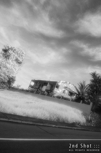
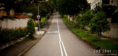
I'm not sure when the plot of land opposite Fifth Ave Condo became a cemetery. I can imagine that, before First to Sixth Avenue was designated as a GCB (good class bungalow) area, the tombs would have stood on good vantage position, commanding a view of Bukit Timah Road and beyond, to the nature reserve. Resting on the grassy slope of Fifth Ave, they would have enjoyed pretty good fengshui. In fact the contours here are quite steep and gave me, a first time visitor, a surprise after the bend at Guthrie House. Fifth Avenue is not connected to and visible from Bukit Timah Road; and judging from the relatively flat Sixth Avenue at junction with Bukit Timah Road I didn't expect Fifth Avenue to be that steep.
The steep slope up Fifth Avenue. Note the traffic sign for slope on the lamp-post.
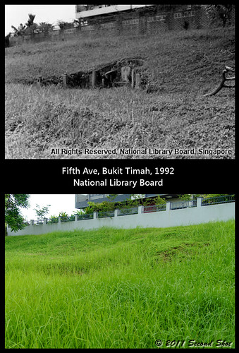
What sparkled my interest was a 1992 photo of the cemetery showing a lone "omega-tomb" below the fence of #11 Fifth Avenue. Since it is not often you have house for the dead and house for the living in one single frame, this is good opportunity for a "second shot". However I do not know much about this cemetery, or this lone tomb, from what I have gathered so far; other than appearing in a 1973 news article on a list of cemeteries closed to future burials, it does not appear in my maps or street directories. As the plot is quite small, could it have been private burial ground for some rich family? Or was the cemetery larger, possibly including the houses around it, in the past? In any case, I don't think the lone tomb was the only tomb in the cemetery, others could have been exhumed before 1992.
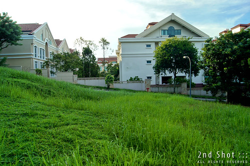
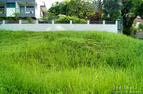
The cemetery opposite Fifth Ave Condo (background) sits on a slope and is under SLA today. I suspect it was private land but (forcefully) acquired by the government.
What is interesting and also obvious is the big hole left after the tomb was exhumed. With some imagination, you can even make out the omega outline cut on the slope and pretend the tomb is still there. Be careful, don't fall into the hole. There is a hole in front of the tomb which had me frozen in my tracks for a while - could this be the position of the coffin? Sometimes ignorance is bliss and this has to be one of those instances. I reassured myself by imagining an alternative position - it could be behind the tombstone, below the mound like those tombs in Bukit Brown. Except this has no mound behind since it is cut on a slope and I do not know the coffin position in Bukit Brown either.
Can you make out the omega outline from this angle? Here is another angle, it is hard to visualize 3D from a 2D photo; you have to be physically there to appreciate the scale and depth.
Eventually ... heck it, I took the plunge. You can see my panorama taken inside the pit. I also found stone remnants inside the pit, perhaps what's left of the tomb or its base. I have not witnessed an exhumation before, but I can imagine when they tore down the house of the dead, some of the rubble could have been littered around and not cleared, even as they exhumed the remains and cremated it to be re-interred elsewhere.
For good measure, I also went up to where would be the mound. This would be the fengshui as experienced by the tomb in its heydays; you can see the position commanded quite a good view of what is below, the Bukit Timah environs, if both tree and house do not exist today.
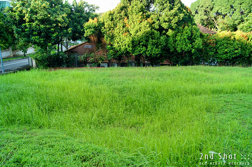
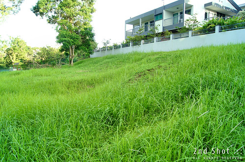
Would that omega tomb be the only one in the cemetery? Though the 1992 photo seems to indicate so, I doubt it. Today even when the plot is not as nicely manicured and actual ground level obscured by tall grass, I could still make out other depressions, not as deep, but nonetheless hint of other tombs in the cemetery.
Here is another one and closer to the road, its depression is visible from this angle. Some depressions are also misleading, like this one, I'm not sure what to make out of it.
Are you an old resident in the area who have more information regarding this cemetery? Do leave a comment! Old photos are also much appreciated. Before the land is sold and redeveloped for residential, let us pause for a moment and remember, as we pass by the place, that this was once a cemetery in a GCB area.




19 comments:
Icemoon. You shd have called me to join you for this exercise. I live just across the road from Fifth Ave. Regarding your last question, I will ask a couple of my neighbours who lived here since around 1970.
I am not surprised that there was a cemetery here before. There used to be cemeteries not far away from this place. For example, along Sixth Ave, bet Laurel Wood Avenue and the former Lor Panchor, there used to be a cemetery back in the 1980s after I just moved here (as I have explained here).
Also there was a cemetery at the junction of Victoria Park and Coronation Road. I think the graves have been removed because I cannot see them anymore in Google Street View. But until a few years ago, they were still there.
Sorry, wrong link. Should be this one.
Some time ago, Peter sent me an aerial photo of this area in 1970. I will email to you. Picture very blur. Maybe you can ask him for a better one. But from the photo, it doesn't look like there is a cemetery as the area was quite built up already.
When time permits, will blog about the cemeteries you mentioned.
You might be interested in this. Mrs Tan Quee Lan's tomb is insitu off Binjai Park still. http://bukitbrown.com/main/?p=3028
Lam Chun See: "along Sixth Ave, bet Laurel Wood Avenue and the former Lor Panchor, there used to be a cemetery back in the 1980s"
The graveyard beside Lorong Panchar (off Sixth Avenue) was a Hokkien burial ground known as Hock Eng Seng Cemetery aka "State Land Lot 2088 pt Mukim 4".
In 1995, the government issued a notice of exhumation for the some 600 graves there. The place can be seen in Tan Pin Pin's short film 'Moving House (1997)' (Vimeo - 21:24 min), which featured the 1995 exhumation of her great-grandparents' grave.
The above site is simply labelled as "Chinese Cemetery" in the S'pore Street Directory (1970 edition), & also on a topographic map (accession no.: TM000842, dated 1970, showing the cemetery plus surrounding area) in NHB's CARDS database.
As for the mystery burial site off Fifth Avenue, NHB CARDS has a land-lots map (accession no.: SP005872, dated 31 Jul 1959) of the relevant area, but the resolution is too low for details to be discerned.
Thanks Pat for the heads up. I didn't know Hock Eng Seng Cemetery was featured in the Tan Pin Pin film.
So this isn't the Bukit Timah cemetary, singapore's 2nd christian cemetry?
sohkiak
@ sohkiak: "So this isn't the Bukit Timah cemetary, singapore's 2nd christian cemetry?"
Nope. The defunct Bukit Timah Christian Cemetery was located at the site now occupied by Kampong Java Park & the KK Women's & Children's Hospital. Here's a location map of the Bukit Timah Christian Cemetery, as published in the 1970 S'pore Street Directory.
Note that the site is labelled in the map as "Old Christian Cemetery" -- ie. as opposed to the relatively-newer Bidadari Christian Cemetery.
The 1970 map indicates:
1) The former location of the KK Maternity Hospital, before it was shifted to its current location across the road.
2) Some structures called "Filter Beds" located to the south (& uphill) of the cemetery. These are water-filter tanks belonging to Municipal Water Works.
* The Filtering Tanks and the Cemetery (14 Jun 1893 Wed - Straits Times Weekly Issue, 20 Jun 1893)
The above is a humorous news article attempt to allay illogical public fears that the cemetery might somehow be contaminating the water tanks. Note that these tanks were not just sited on higher ground, but also separated from the cemetery by "many yards wide" of dense clay soil & a concrete wall. (Apparently, the intervening section of Bukit Timah Road hadn't existed yet back in 1893).
I just came across this photo (image 11/17) of a traditional Chinese tomb at an unspecific "Bukit Timah cemetery" in the photo-story 'Flashback: Qing Ming' (Straits Times - Through the Lens).
Accompanying photo-caption: "A mother and daughter kneel as they pay their respects during the "Cheng Meng" (Qing Ming) Festival at Bukit Timah cemetery on Apr 7, 1957. (Photo: Han Hai Fong/ The Straits Times)"
The tomb in the said photo is Hokkien-style, so the said cemetery could be the one at the top of Fifth Avenue (as depicted in Icemoon's post above), or Hock Eng Seng Cemetery beside Lorong Panchar (off Sixth Avenue).
Other than Bukit Brown & the adjoining Seh Ong Cemetery, I've never seen a traditional Chinese cemetery. As such, might anyone know the answers to my curious questions regarding the other cemetery photos featured in the aforementioned 'Flashback: Qing Ming' photo-story ?
Image 1 (Apr 5, 1951):
Are these very basic Teochew-style tombs, or simple Cantonese/ Hainanese-style tombs ? Where is this cemetery site ? (I have come across 2 tombs with such a style at Bukit Brown, & these 2 tombs are a rare exception to the rule at Bukit Brown.)
Image 2 (Apr 5, 1956):
Which dialect/ regional group does this house-shaped tomb belong to ? Where is the cemetery site ?
Image 9 (Apr 5, 1955):
Looks like standard Teochew-style tombs facing various directions (unlike the orderly Bt Brown). Where is this cemetery site ?
Image 10 - "cemetery along Upper Serangoon Road" (Apr 7, 1974):
These tombs look vaguely like Hakka-style tombs that I'd seen in photos of overseas Hakka cemeteries, but was there a Hakka cemetery at Serangoon ?
This comment (06 Aug 2012) indicates that there was a Teochew cemetery called 广义山 along Upper Serangoon Rd. However, the tombs in ST's photo don't really resemble the Teochew tombs located at Bukit Brown or overseas.
In addition, NLB's S'pore Infopedia (24 Dec 2004) states that in the Serangoon district along Plantation Avenue, there was "a cemetery known in Chinese as si phua pak tiong or 'cut stomachs of the dead cemetery' as most of the corpses buried here had undergone autopsies before burial". Is this a Hokkien or Teochew cemetery ?
Image 13 - Pek San Teng Cemetery (Apr 15, 1952):
This is the 1st time I'd seen a group of pauper graves being enclosed & guarded by a single Earth deity ... how interesting ! The individual graves here are located so close to one another. Did the Cantonese community have a practice of sometimes burying the deceased vertically instead of horizontally ?
One thing that I noticed while searching for photos of the various Chinese cemeteries in S'pore during the past year: Photographic close-ups of local Chinese tombs are extremely uncommon. Other than the modern-day photos of the tombs at Bukit Brown, I have never seen close-up images of local Chinese tombs -- until I found ST's photo-essay. Did the local Chinese community have a taboo against taking photos within cemeteries, especially that related tomb photography ?
Hi,
Perhaps to let you know more information to find out about Private Tomb and yet to discover tomb..
I have came across during my NS time. Thay are located in Sungei Gedong exercise area. Maybe you could find more information about them before they are gone.
Hi Nicholas, I have read about them vaguely online, but not sure of their location. Don't remember seeing them during my NS days at Gedong for exercise.
On my NAVphone I am seeing a Chinese cemetery at junction of Victoria Park Road and coronation Road but when I drove there, only saw GCBs?
Hi Anon, the cemetery at Victoria Park Road already exhumed.
Hi I would like to find out more about the Victoria Park Cemetery any info?
Are anybody alle to tell me about the Former Hock Eng Seng Cementery in the middle of the wood oposit the Regent Villa busstop. I have tried to enter the wood but could not.
You can answer me on mail: anker@ankersteen.dk. I am from Denmark. Kind regards Anker
Of course I should have said forrest and not wood. Sorry
Back in the early to mid 1990s, my dad drove me to Chinese High School every morning: Clementi -> Ulu Pandan Rd -> Holland Rd -> Sixth Ave -> Namly Ave
I remembered there were many tombstones on the left as I was travelling north along Sixth Ave towards Bukit Timah Rd, probably on the grass field near Ming Teck Park. Sometimes there would be a morning mist, and the cemetery looked scary.
I think this can be verified with older street directories.
Regarding cemeteries in the Bukit Timah area, see also the Chinese War Emergency Cemetery that was a Coronation Road and Victoria Park Road. https://www.bukitbrown.org/2012/02/chinese-war-emergency-cemetery.html?m=1
Post a Comment