After my trainspotting at 10 miles Junction, I trudged my way to (Old) Keat Hong Camp at Choa Chu Kang Ave. 1 for another heritage mission. At Choa Chu Kang Way, just before the left turn into Ave. 1, something on the big field caught my eye ....
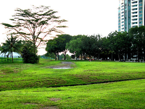
The old Keat Hong Camp lies behind the fence on the left. Palm Gardens on the right.
This could be it, I told myself.
Could be what?
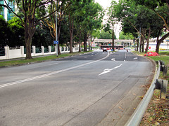
If you stand at the road bend beside our object of interest, you'd see the two lanes merging and Ave.1 changing from a dual carriageway to a single carriageway.
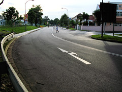
Left: In the direction of old Keat Hong Camp. The road becomes a single carriageway after the bend, the double white lines changing to a single white line.
Right: Palm Gardens on the left. The two lanes merge just before the bend.
Let's take a closer look at our object of interest. The place is state land now and dumping and burning are not allowed. However I found evidence of burning - from the seventh month?
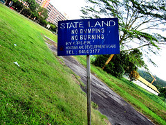
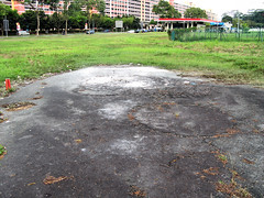
Left: State Land - no dumping, no burning. By order, HDB.
Right: Did somebody disobey the no burning order?
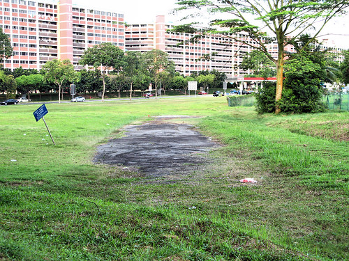
Our object of interest in all its splendor. Erm, splendor?
Let's move on. No, I did not make a mistake. I really mean - let's move on.
The next destination was not unexpected like the first. You see, while looking at the street directory, I saw a Keat Hong Shopping Center beside Ave. 1. I thought, wah, a shopping center at the fringe of the new town. Maybe it would be like the one at Holland Village. A good place to enjoy the aircon. A good place to buy a drink. A good place to rest the legs.
That was during planning.
Imagine my excitement turning into disappointment upon seeing the real thing.
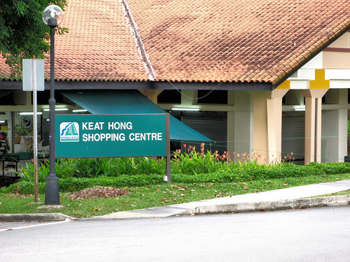
Let me introduce you .... Keat Hong Shopping Center! The building behind is called - unabashedly - Choa Chu Kang Market.
We have come to the last of the trio. The mystery, of which there are actually two.
The first is our object of interest. It looks like a road, or what used to be a road. The road should be Choa Chu Kang Road. It is quite sad as this once famous road exists only between Teck Whye LRT Station and Ten Mile Junction today, widened, so the stretch doesn't look original. Ironically the stretch that looks original, at Tengah, is not Choa Chu Kang Road but Old Choa Chu Kang Road. So the new has usurped the old and original.
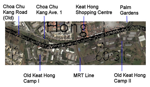
The second is Choa Chu Kang Road as it passed through the old Keat Hong Camp I. During my search for the artillery gun, I did a (mid 1960s) map overlay on Google Earth. The overlay showed the road passing through the present camp compound. This means the 1960s Choa Chu Kang Road did not follow the alignment of Choa Chu Kang Ave. 1 outside Keat Hong Camp I. This is not altogether inconceivable as there are no buildings along the suggested path of the road. So 40 years ago, the road might have ran inside the camp. Or maybe the camp was built after that. Or maybe the camp was smaller in the past. Do you happen to know the answer?


20 comments:
it could have been a smaller camp. Think about it... even schools also had extension building here and there popularly back in our school days *ahem*.
It's no surprise that the camp decided to have an 'extension' too. and maybe cos of that they had to 'scrap' off the old road and build a new one.
I have to read 2 times to understand what you were trying to relate. LOL. Don't mind me, it's just the slow processing brain of mine.
Adelin, please don't say that. It is also the author's responsibility to transmit the message clearly.
Although I have never been posted to Keat Hong Camp before, I remember it well. When I blogged about my first day of enlistment here; I think I forgot to mention our detour to this place called Keat Hong Camp.
On that unforgettable day, we assembled in CMPB in Dempsey Road and were herded into 3-tonners (first time experience for many of us) and sent to our camp in Safti (now called Pasir Laba Camp) in Jurong. Enroute, the trucks brought us to Keat Hong Camp to pick up some personal items. I think it was Camp 1.
Shortly after turning into Chua Chu Kang Road from Upp Bukit Timah Road, it is on the left. It was also called GEB; or General Equipment Base. We collected some of our army stuff before the trucks proceeded to bring us to Safti.
By the way, just in case younger readers are not aware, in those days before CCK new town and KJE came into existence, CCK Rd was the main road leading westward from Bukit Timah/Panjang to Lim Chu Kang/Jalan Bahar. It passed through mainly rural land and rubber plantations. The most prominent landmark along this road of course was Tengah Air Base. One of the first things I blogged about was my 1969 cycling trip along this road.
Sorry, I think my link to Safti in above comment was incorrect. Here's the link again.
I was shocked each time I use Chu Chu Kang Road (I still use the old spelling for this road) during the Christian "All Souls Day" to pay my respect to my ancestors. I get confuse especially after the former Jalan Teck Whye post office and level crossing. How come one stretch of Chu Chu Kang Road disappeared? The other prominent landmark I have to remember is the SHELL Station just before Tengah Air Base. There was also a wet market thne but no longer there today.
Keat Hong Camp 2 was the original British Army camp built before WW2.
So Camp 1 must have taken place after SAF took over.
Back in the early 70s, I came to Tengah Air Base to play Inter-Formation rugby game against the air force. The field is still there opposite the air base but much reduced in size now days.
Haha, what is Chu Chu Kang Road? Or does Peter mean Chua Chu Kang Road? I always thought Chua is dialect for 蔡, I don't know how Choa or Peter's Chu came about.
I thank Chun See for sharing the history of Keat Hong Camp. I always associate the camp with armour, so GEB is news to me.
I have explored the stretch after Track 14, including Peter's rugby field but don't remember seeing any Shell station.
Apologies. My "A" keycap got stuck. Should be Chua Chu Kang Road.
There were 2 service stations - CALTEX and SHELL and a bend just before Tengah Air Base. Now only SHELL reminas. I think it was the original spot for the Tengah Village Wet Market.
Actually, they never admend anything. The road is the only they admend, Last time no such tall buildings. The 2 camps, they never do anything to it.
This may be 2 year late, but I hope to shed more light on Old Choa Chu Kang Road.
I went to serve my NS in 1994. The GEB mentioned, occupied the area bounded by today's CCK Way and B. Batok Road, all the way to the canal along Brickland road, the road of which did not exist at that time.
For old CCK Road, i did a rough map from memory.
http://www.flickr.com/photos/51314121@N06/5560143749/
http://www.flickr.com/photos/51314121@N06/5560143211/
The brown line represents the old CCK road that I remember. The Old CCK road turns off somewhere after ITE west, joins today's CCK Ave1 at where Keat Hong Camp I was. As it passes the old estate, where Keat Hong Camp II was. It carries on, crosses the bridge, along today's Jln Lam Sam (part of old CCK road) and links up with the existing old choa chu kang road.
I hope i've been helpful.
hi icemoon~ do u have idea who is in charge of this building now and who to call if i want to rent the place?? thx lots!
Hi Anon, if you mean Keat Hong Shopping Ctr, that would be under HDB.
Hi, in the map overlay, the line pointing to Old Keat Hong Camp II should actually refer to Keat Camp IV, which is the location for SAF GEB or General Equipment Base. I was posted there and served from 1980 to 1982 in HQ GEB in Operations. My office was located in the building called Base Office (very unimaginative)which is actually the rectangular building to the right and just before the top end of the line. The top end of the blue line also indicates the main entrance road leading into the camp; the old guard room was located on the white rectangular patch just above and to the right of the blue line. That was where "old" Chua Chu Kang Road ran and it was outside of the camp (for sure). The bus stop along that road directly opposite the camp entrance was next to residential estate that was already situated there. If you want, I can post a pic of the camp when the guard room was still there.
Sorry, just to correct, the old guardroom was on the white patch to the left and just above the end point of the blue "Old Keat Hong Camp II" line!
Hi Terence, do post if you have a blog and send me a link. Or you can share with me via email. :)
I will hunt for the picture and when I get it I will email you. I am pretty sure that the camps (Keat Hong camp IV, 1) were not changed, and its clear from the satellite photo that they follow the pattern of Choa Chu Kang Road (old one) so maybe you overlay wrong (sorry, couldn't resist!) Look in particular at the alignment of the nissen huts to the lower right of the blue line end point for Choa Chu Kang Ave.1.
I now live in Choa Chu Kang Ave 5 and a reinforced solid concrete bridge truss like structure has just been demolished and cleared after many months of incessant hydraulic jackhammering noise , this must have been a leftover from Keat Hong Camp 4 and my residence must be sitting on what used to be the camp premises
You see the thing just outside the old camp's fence that looks like a road or pavement? That was part of Choa Chu Kang Rd, before Choa Chu Kang Way was constructed, before the junction at the condominum even existed.
Hi,I've just visited my niece's new home at block 807c,directly opposite Keat Hong Shopping Centre.I was at HQ4SAB in Keat Hong Camp II from Mar 1984 t0 Jun 1986.I remember taking bus service 177 or 172 from Bukit Timah Road and alighting at a bus stop just opposite a coffee shop with a stall selling very famous cha kway teow.Back then,the two camps were one bus stop apart.As I observed,that stretch of CCK road remians exactly the same without any realignment or widening.
I stayed in cck track 5 till I am in JC2 in the 80s. I hope that the Tai Cheong Primary school building that was on top of a small hill still there. Wish to go there to explore on day.
Now a HDB estate,both camps are gone,as well as Tai Cheong Pri Sch.I served in 4SAB early 80s.Some of my friends staying in CCK Track 5 told me that there was a soccer field on the other side of the fence(in the camp) next to Track 5 in the 60s.I can't recall any such field.Do you remember whether the field was still there in the 80?It might have been transformed into a build-up area when I joined in 1984.
Post a Comment