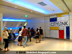
Even today, 10 years after CityLink Mall's opening in July 2000, I still have that magical feeling strolling along Singapore's first subterranean mall. It seems pretty amazing to me from City Hall MRT Station, you can enter a passageway and somehow end up at Suntec City. I have never tried to orientate myself to the world outside and wonder what is actually above us everytime I follow the crowd blindly to my destination. A pity, as we can make some pretty interesting observations from the way CityLink is built.
Do you notice something strange about the way CityLink is constructed? If you believe CityLink to be a commercial project, then convenience sometimes gives way to commercial interest - just like how the up and down escalators in some shopping malls are strategically located to give their shops "maximum exposure" to traffic.
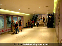
There is one memorable stretch in CityLink, at the end of the straight passageway from City Hall Station, where we are "forced" to walk down some sort of underpass. Subconsciously most of us go through the routine without realizing the absurdity - in the absence of commercial reasons, why is there an underpass in a subterranean mall?
If you have woken up to the fact that you have been made to walk up and down for no apparent reason in a subterranean mall, then the other observation should be painfully obvious now. Why is there not one but two such underpass in CityLink? Just recall the last time you walk from City Hall MRT to our Big Durian.
The last observation has to do with distance. My friend Roy once told me the CityLink route is the longer way to Suntec City, compared to using the walkway above on street level. That was his perception of course, though I believe most people would use CityLink to avoid the weather and vehicular traffic, never mind the human traffic at subterranean level. Make a scientific guess, which do you think is the shorter way to Suntec City?
To be honest, these questions never crossed my mind. I guess for most of us, chatting with friends, admiring the window displays, ogling at the opposite gender or thinking what to eat and which movie to watch at Suntec/Marina Square preoccupy us inside CityLink Mall.
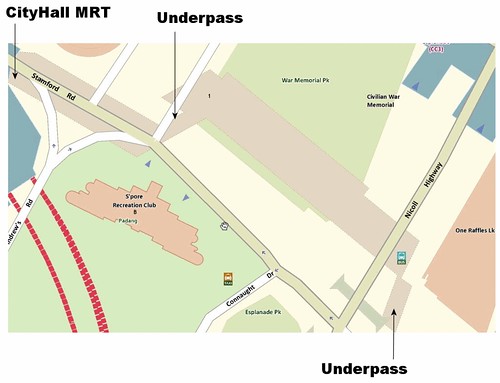
Unable to contain my curiosity, I checked the map for possible answers. Where are the underpasses, why are they in a subterranean mall and whether the CityLink route is the longer way to Suntec City.
Looking at the map, the answer is quite obvious.
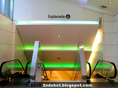
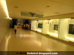
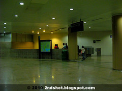
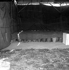
- One underpass (photo set A) is located below Stamford-Beach Road junction. The other which leads to the Esplanade (photo set B) is located below the pedestrian mall that is between One Raffles Link and Nicoll Highway.
- The reason for their existence is not commercial; rather they are a solution to a common civil engineering problem. The culprit is none other than the one responsible for the Orchard Road flood in June 2010. The younger generation may not remember the Stamford Canal running alongside Stamford Road that is hidden under the pedestrian mall today. On the map (but not drawn), the canal runs between CityLink and Raffles City before Beach Road. At Beach Road junction, CityLink goes down under the canal then up again at the War Memorial Park side. The canal now runs on the right side, between CityLink and Stamford Road. Before One Raffles Link, the canal runs above the underpass linking CityLink and Esplanade.
- Roy is right. The CityLink route is the longer way. Most people will cut across the War Memorial Park diagonally when taking the street route whereas CityLink is built at right angle to One Raffles Link. Mathematically, the hypothenuse will be shorter than the sum of the two other sides in a right angle triangle.
As to why CityLink Mall makes a left turn at Beach Road junction and not continue straight under Stamford Road, I think it has to do with a wider Stamford Canal after Beach Road. To avoid the canal, the mall would require "more land" under the Padang but as a result the mall would be built too close for comfort to the Singapore Recreation Club.
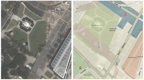
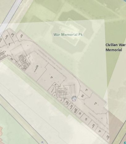
Therefore the solution for avoiding the canal was to site CityLink more on the War Memorial Park side. Here, as depicted by the overlay above, CityLink actually lies on a "comfort zone". It could not expand right due to the canal, neither could it expand left or, God forbid, cut across and under the Civilian War Memorial! Do you know why?
The significance of the War Memorial is lost on the younger generation today. Locals call it "The Chopstick Memorial" out of affection as it looks like two pairs of chopsticks. Most will probably tell you it is to remind us of WWII and a memorial service is held there every Feb 15 (Total Defence Day).
There is an urn in the centre of the monument but it looks pretty much symbolic - even I am not sure whether there is any "content" inside. However, do not let the serene atmosphere fool you. In reality, the monument is built on a burial chamber containing the ashes of victims exhumed from the mass graves discovered early 1960s. That the War Memorial is the burial place for the tragic victims of the 1942 Sook Ching massacre is perhaps its best kept secret. No way CityLink is going under the burial chamber!
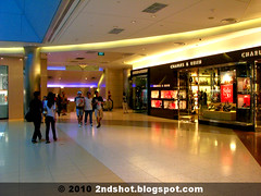
There is one last oddity about CityLink Mall. The stretch where you find New York New York and HMV today, notice anything special? Right, that is the only place inside CityLink where shops only occupy one side of the walkway. A wall occupies the other side, with the occasional products on display (I remember the Sony Vaio notebooks on display last time).
An overlay of the CityLink Mall floor plan over OneMap and Google Earth (potent combo) reveals a disturbing observation. With the burial chamber a mere 30m away, a case can be made that nobody would want to open shop back-facing the burial chamber. I am no fengshui expert, but I guess water from Stamford Canal behind and the incessant crowd in front would help remove away some of the bad luck for the two mega-shops.
CityLink Mall floor plan overlay. The War Memorial is just 30m away (Source: Hongkong Land)
It is perhaps no coincidence that CityLink Mall was developed by Hongkong Land. I suppose Hongkies are usually more pantang (taboo) about such things and might have used a little geomancy to influence the floor plan design.
We are lucky CityLink Mall is open 6am to 12 midnight. Any time after that, they probably tell you to walk at your own risk. This is no joke as the burial chamber contains the ashes of those who died very tragically and they probably do not welcome you sharing the subterranean level with them.




11 comments:
i will do a research too later..:)
im spooked, but this is really interesting.
Charlie Chan's investigation goes underground to find out whether the Stamford canal was the cause of the devastating floods in Orchard Road last month. Keep us updated of the outcome of your snooping, Charlie.
Hi!
... "outcome of your snooping, Charlie."
Would it take a Charlie Brown and his beagle, Snoopy, to get to the root cause? Hahaha!
It was admitted in Parliament Stamford Canal had a more direct role in the flood. I will uncover the canal in my next post hopefully. Akan Datang!
This is so fascinating! Now when I walk through here I'll think of the burial site. Thanks so much for sharing this.
Flora
Flora, do read my other posts on Stamford Canal. CityLink goes under the canal!
This is interesting! I have walked along CityLink Mall N times since primary school and still do not know about this. Thanks for sharing!
Hi MakHooi, thanks! Hope you learn more about Singapore from my blog. Cheers.
Then is the canal still operational?
Yes it is. You can sometimes hear the gushing of water above the pedestrian mall walkway outside the SMRT HQ. Stamford Canal lies underneath.
Post a Comment