Singapore, Pre-Independence.
The boy's eyes are on the bridge. It is more complete now. The iron black structure is taking shape. When he first came to the area, there was nothing. Then a pillar went up. And another one.
The construction captivates him. The few times when he was here, he had never failed to check on the progress of the bridge. The bridge is growing, just like his furry Alsatian friend at home.
He closes his eyes. It is easy to imagine how it will look when completed. Just a bit more and it is done, he tells himself.
However, in the mind of the 8-years old boy, he has no idea what the bridge is for.
Perhaps it has to do with the huge excavators digging nearby, he muses.
Singapore, June 2008.
The lad stops at the traffic junction. He is back at where he started more than 2 hours ago. The sun is punishing but he feels satisfied. The trip has been pretty fruitful so far. He gives himself a pat on the back. Now for the next mission.
His eyes trace the curved line of the river bank to a graceful white structure sitting across the water. It is a beautiful bridge and I'd like to walk across it, he smiles.
Eyes on it, he stared for a little longer to reveal the hidden treasure - a dark mass lurking behind the bridge.
So that was what the boy saw. And he smiles again.
But instead of walking towards the duo, he makes a right turn. I'll be there, he promises, stealing a glance at the bridge.
With both legs in tow, he begins the long journey up Clementi Road.
The above are fictitious stories from true accounts. Therefore, any resemblance to real people is not purely coincidental.
By the way, the stories came from me. Therefore, if you can understand and (hopefully) appreciate the plot, good for you - you have managed to overcome my less than perfect English. If you cannot understand and feel the plot sucks, then woe to me - I need to learn how not to torture you.
At this point, it is timely to ask the question - what is fictitious and what is true?
The story of the boy was inspired by Peter Chan's articles on the "Lost Railway Line". There, Peter introduces us to a now disused railway line in the west of Singapore. Peter, a renowned heritage 'guest' blogger, dons his railway guru cloak and recounts the origin of the line. I leave you to guess who is the boy.
There are three articles in total, Peter wrote two of them (here and here) and blog owner Chun See wrote the opening article.
The story of the lad came from my experience that day (June 1, 2008). I was fascinated by the articles and within a week from the publication of the last article, I was off for my mission.
This blog will continue from where the stories trail off. If you recall, the first story ends with a passing mention of excavators and in the second story, the lad simply left for an undisclosed location.
The undisclosed location up Clementi Road turns out to be this:
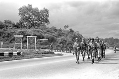
Source: National Archives of Singapore. PDF soldiers marching out from Lorong Gaung to Clementi Road
The same photo is used in the article. Peter recalls (emphasis mine):
I used to travel the stretch of Clementi Road and Bukit Timah Road very often. Around 1960 or 1961, I saw huge excavators digging at the spot where Lorong Gaung used to be. The space next to Lorong Gaung finally became a deep valley which is now the tunnel under Clementi Road.
It is hard to imagine the place from the description because Lorong Gaung has since been expunged and the deep valley is now not very obvious. In fact, Clementi Road has changed over the decades - it has been widened, realigned and there is now a road divider in the middle. The archive photo is dated 1967.
Here, the lost railway line comes into the picture. If you have not realized, the deep valley is actually the railway track's resting place.
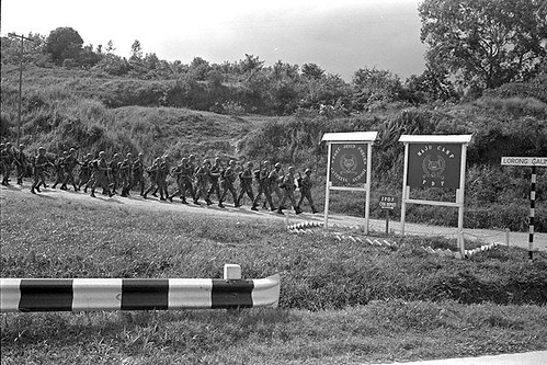
Source: National Archives of Singapore. Soldiers marching along Lorong Gaung near its junction with Clementi Road. Note the 'Lorong Gaung' street sign on the right. The space next to Lorong Gaung is a deep valley - the road barrier is tell-tale!
Let's retrace the journey of the lad up Clementi Road. Almost reaching ....
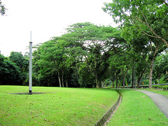
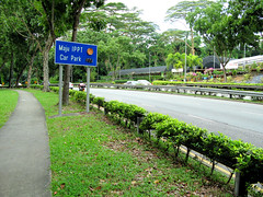
Left: What's that funny pole object for? Right: Approaching Maju Camp, Corona Florist on the right.
You have reached!
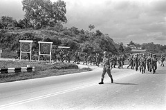

Left: PDF soldiers marching out from Lorong Gaung to Clementi Road, from National Archives of Singapore. Right: The same place today, taken from Corona Florist side of Clementi Road.
When Peter said "the space next to Lorong Gaung", he wasn't joking. We will verify later that the valley is right next to the dirt track. Here, note that the road barrier in the old photo would be roughly where the tree is today. You can see this prominent tree by the road in the picture taken from the Corona Florist side of Clementi Road.
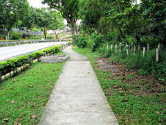
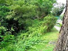
Left: Entrance of Lorong Gaung marked by road block pillars. In the background is Corona Florist. Right: The valley entrance marked by the tree.
The road block pillars can stop vehicles but not my curiosity. So I decided to explore Lorong Gaung.
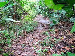
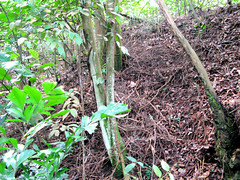
Left: This is how the entrance of Lorong Gaung looks like today. The dirt track of the 60s is almost covered by plants. Right: The small cliff beside the road.
If you look at the old photos, the dirt track lies between a small cliff and the valley. In Peter's words:
It was scary to see the 3-tonners getting stuck halfway up the muddy steep dirt-track and men pushing the vehicle forward. When the vehicle finally could get started, you could see the rising black exhaust smoke.
I have not thought that far. I'm still thinking whether the dirt track is passable to 3-tonners coming from opposite directions. Maybe, but for the passengers behind, it will be a terrifying experience. The driver, a fellow soldier like them, may have only a few months (or weeks!) of driving experience.
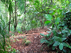
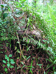
Left: Once inside, the valley will be to your left. Right: At the entrance, there's a big stone with metal hook on top. What's it for?
I did not stay inside Lorong Gaung for long. I wouldn't want to anyway.
Till now, I have not shown you the lost railway line. So let's go back to the tree and have a look at what is down in the valley. However, if you expect to see a nice railway track down in the valley, you'd be disappointed. It takes a bit of challenge to even find the railway track.
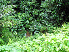
Peering down the valley.
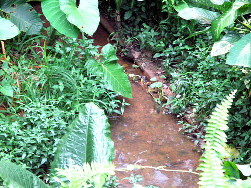
Peering down the valley with zoom lens.
I don't think it's a good idea to jump down into the valley and walk along the track in normal street attire. That's not prudent. So let's find an alternate trail that will bring us to the railway line.
Looking at the map, a good plan will be to cut across the park and hopefully find a way to rejoin the line.

Source: Singapore Land Authority.
At Clementi Neighbourhood Park, the place is desolated. The place looks like a ghost town.
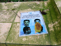
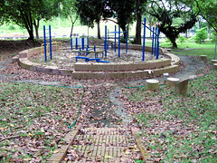
Left: The wanted man is still missing. Right: No evidence of area cleaning done at Clementi Neighbourhood Park.
Further down at Sunset Way Residence, my hopes were dashed as there was no way to get across to the tracks because of the fence. I almost wanted to climb over the fence or find a hole, but desisted. I knew there has to be a 'public' opening somewhere. So I walked along the perimeter of the residence - blk 117, 114, 113, 112 ....
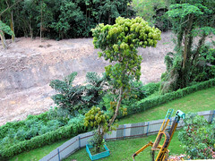
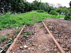
Left: On one of the flats, the railway line is barely visible across the fence. Right: The track just before the Sunset Way Bridge.
Finally I reached the Sunset Way Railway Bridge. And I found the 'public' opening - a mud track up from Sunset Way. I saw evidence of construction work along the track. As it was a Sunday, nobody was at work.
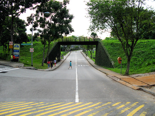
Sunset Way Railway Bridge. Mud track on the right..
How does it feel to stand on that bridge? I will show you later. For now, let's walk along the track, backtracking, to see what lies beyond the fence and how far back we can go. Theoretically we can even walk back to the valley at Lorong Gaung.

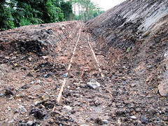
Left: A tree beside the track? I think the tree is a later addition; it is too close to the track for comfort. Right: The track towards the bridge direction.
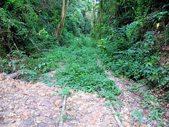
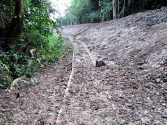
Left: End of mud trail and the beginning of thick vegetation. Right: The bend at the end of the mud trail. The flats and park will be to the left.
The walk took me as far back to the edge of Clementi Neighbourhood Park. There was no point in continuing because of the thick vegetation. You never know what insects, animals or ground condition lie beyond. The endpoint is quite desolated. I did an uncivilized thing there.

What's this marker beside the track? A milepost?
Back to the bridge where I will attempt my first railway bridge crossing. A few years before, I almost wanted to cross the railway bridge at you guess where - Bukit Timah Road. That's probably suicidal; I can still remember what was taught during my JC Physics class on the Bernoulli effect if a train gets too close to you. On that day, there really was a train coming and I was shooed off the track by an official before I could do anything funny.
At least the train won't be coming this time. Phew.
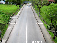
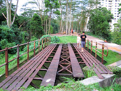
Left: View of Sunset Way from the top of the bridge. Right: The bridge is like some kind of obstacle course for civilians, but they seem to walk across effortlessly.
On photos of the bridge with no people on top, it is easy to miss the hidden dangers. When I first saw the bridge photo in Peter's article, I thought crossing it is a piece of cake; maybe I can even run across. But looking at my photo, this rather small bridge has gaps big enough to cause human tragedies, if you are not careful.
Furthermore, I learnt that given the right "vibration", a structurally sound bridge can actually collapse. I read of bridges collapsing from troops crossing. A civil engineer will know what I'm talking about.
You may think I'm over-imaginative, but such thoughts do haunt you when you're on the bridge. It can't be helped that the bridge makes a low, metallic creaking sound when you walk across it. I can feel it. Atoms are vibrating in the metal and if the right number of people walk on the wrong places, the game is over.
Perhaps Franklin D. Roosevelt is right, the only thing we have to fear is fear itself. Fear, or "kanchiongness", may cause you to drop the camera while on top, or your legs to slip into the gap. So just walk across the bridge, just do it. No point standing there worrying for too long.
After crossing the Sunset Way bridge, a short walk along the track will bring us to our final destination - The Bridge on the River Ulu Pandan.
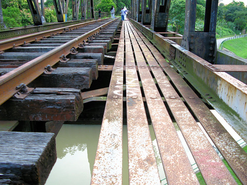
The Bridge on the River Ulu Pandan
Unfortunately, there are people on the other side of the bridge. Like the English idiom, two's company, three's a crowd. Their presence makes my task even more daunting.
But you have to admire their boldness. These guys were filming idyllically (you can see people standing on the sleepers!) and the railway bridge probably felt like a pedestrian one to them. They were on the bridge for quite some time. They were there before me. They were still there when i left the area.
If you read the part on Lorong Gaung earlier, I raised the possibility of two tonners sharing the dirt track. The scenario is terrifying enough for the passengers. Now, I have to do something similar, except I'm both driver and passenger and there may be more than two tonners. Well done!
The task couldn't have come at a more opportunate time. I've been walking the whole afternoon and concentration is falling. Besides, it is getting dark and subconsciously my mind is switching off.
I almost wanted to chicken out.
True, I have crossed my first railway bridge at Sunset Way. I should have the confidence, but note that, in comparison, this bridge is longer and there's nothing for you to grab as a support and assurance once the bridge is over the water. It is like walking on a tightrope. It is a fat rope all right but still, I don't want to make a big splash and attract attention. In a wet, dishevelled state, you may be captured and put on STOMP. No way!
Worst, this bridge has the same low, metallic creaking sound reverberating!

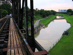
Left and right: Graffiti on the bridge. You can call it vandalism or art. Sungei Ulu Pandan flows below the bridge.
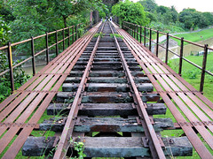
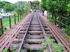
Left: The view before crossing the bridge. Right: I have crossed the bridge!
I mustered my courage, or what is left, and crossed the bridge all right. You can imagine every step is executed with trepidation and the mind has no time for other activities. In fact the mind is constantly in a state of petrify. I long gave up the idea of taking a shot standing on the middle of the bridge, like the one at Sunset Way.
So what lies after the bridge? Since that day, I have continued my trail down the lost railway line. If you are interested, do watch out for my next "Old Tracks, New Trail" blog adventure.
At the end of his article, Peter writes:
Coincidentally the S. Ulu Pandan railway bridge has a uncanny resemblance to a bridge in the movie, “Bridge On The River Kwai”, especially during sunset and when there are no HDB estates around it. Close your eyes, you can hear “Colonel Bogey” whistled by the POWs.
This sounds like a good experience, so in my plan I scheduled the trail to place myself at the Sungei Ulu Pandan railway bridge area around sunset.
I have not seen the movie but I know the background story which is about the building of the Death Railway during WWII. Therefore I cannot comment whether the bridge here bears a uncanny resemblance to the bridge in the movie. But I remember Colonel Bogey 'cos my school used to play that every morning as a bugle call.
On the Clementi HDB estate side of the bridge, the Ulu Pandan Park Connector goes below it. The connector is heavily utilized by cyclists, joggers and even anglers. This is so different from the Clementi Neighbourhood 'Ghost' Park. But this is not a good place to get the experience Peter describes.
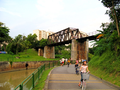
The Bridge on the River Ulu Pandan and Ulu Pandan Park Connector
What Peter has in mind is probably on the other, Sunset Way side of the bridge. There, if you find the correct angle, not a single HDB estate will be visible. I believe I have found such an angle. I can whistle the Colonel Bogey tune now.
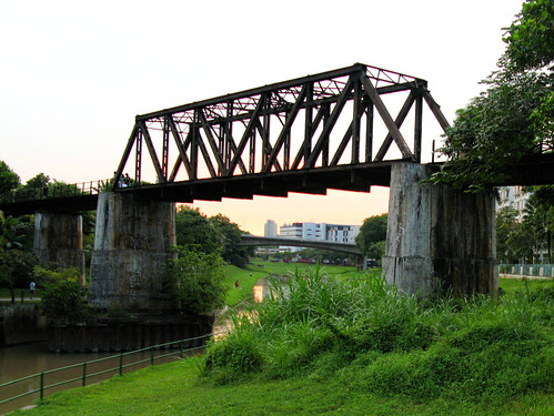
S. Ulu Pandan railway bridge at sunset.
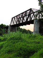
S. Ulu Pandan railway bridge at sunset, with no buildings in sight.
As my return journey took me past the Sunset Way bridge, I took a parting shot of it. The place certainly lives up to its name.
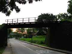
Sunset Way railway bridge at sunset
Here'a short question before I end. From the bottom, can you tell which is the Sunset Way bridge and which is the S. Ulu Pandan one?
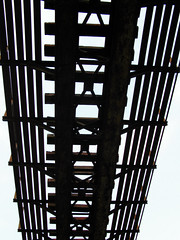

This is easy 'cos one of them still has track (and sleepers) on it. The other doesn't.
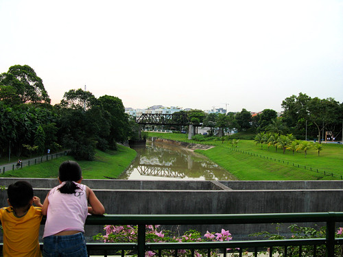
On the white canopy pedestrian bridge.
My return journey to the Sunset Way area took me past the pedestrian bridge this time. Recall in the story at the beginning, the lad saw this "graceful white structure sitting across the water". Now that you're on it, you can see for yourself the "dark mass" behind it.
Looking at the boy in the photo, you can't help but think of the scene in the story around 45 years ago - the boy, eyes on the bridge, totally engrossed by its construction ....
PS: All Peter's quotes are from his article here.


21 comments:
I've always wanted to know what it was like in Lorong Gaung! I've only explored the Jurong railway from near the KTM before it enters the thick of a forest.
Thanks so much for the pictures and the fascinating article. I've always loved "second shots", and I'm so thrilled someone is doing it in Singapore.
As usual, a very captivating article that inspires awe.
BTW, I have always wondered but were afraid to ask - how come you can get your hands on National Archives' photos which do not have the irritating watermark "For on-line viewing only"?
I left the answer in your email liao.
Wa, your email hard to find leh. Luckily I'm a yesterday.sg member as well .. lol
Ah .. today I learned some history from a 'lad'. Thanks for doing the leg work that this 56-year old is too lazy to do.
Someone should approach Eric Khoo to make a movie out of this story.
The 3-tonner I mentioned was a US-made vehicle from the 6-Day Arab-Israeli War. Some say it was a captured Eqyptian vehicle from the Russians. I am not sure but I know it came from that War and was left-hand drive. Maybe the first batch of NS boys would know something about it.
If this is made into a movie, Peter will be like Harrison Young in Saving Private Ryan .. lol
Very engrossing reading as usual :)
Always thought that the bridge was just a structure over the river for pipelines and stuff. Now I know better.
Take care when exploring the forested areas, dengue is always an issue in that area.
Icemoon. I am very encouraged by your response to our articles about the old places. We hope your passion is infectious on other young Sporeans.
On your own, we doubt you can keep up with these 2 old soliers. We have since moved on to Bedok and now Changi. If time permits, I really would like to do some research into the old cemeteries at Bishan.
Icemoon. I think you needn't have worried about the bridge collapsing. They were designed to take the load of a moving goods train. Furthermore, in the old days, they tended to over-design. But falling through the cracks etc. is a different matter of course.
By the way, I have also started to explore stretches of the old rail way line along AYE and Teban Gardens - only those places easily accessible by car I must add. Don't be surprised if we bump into each other one of these days.
Nice post! I liked how you compared the Before and After photos at the early part of your article. Chun See led me to this post. Keep up with your stories.
There is also another mystery railway line but of a military nature. It linked Keat Hong Camp to Kranji Camp during WW2.
If you want to know where in present-day was this track, check out the MRT track between Yew Tew Station and Cho Chu kang. It passes through a valley near Keat Hong Camp.
The line from Harbourfront to Pasir Panjang Road called the Circle Line also follows a railway line built at the turn of the 20th Century. The remnant can be found inside Prima Flour carpark in Teluk Blangah Road.
This leads me to suspect that LTA engineers might have access to all those old railway lines in Singapore.
Sala! very sori. The 2 MRT Stations are Cho Chu Kang Station and the station before it - er Gombak Station? tells u how much i use f legs than 2 legs. Look for Lorong Kebasi.
Hi passerby, I'm glad you enjoyed it. More second shots to come on the lost railway .. if I succeed.
Roy, thanks for the reminder. I'm not sure why I survived dengue in green but kenna dengue just below my block. I should have immunity from one strain liao, not sure i want to be immuned from the other three strains ..
Chun See, I owe you oldies a debt of gratitude for continuing to inspire me with your stories.
You are right, I cant keep up with old soldiers. I will always be at least one bound behind, as I'm a generation after you. :P
Peter, thanks for the information. I have to say I learn as much from your blog comments as from your blog articles. I may not be able to find those super old railway lines, but from the old contour maps I keep, I am surprised to find so many other lines. Maybe it's time to pay them a visit.
Peter,
The military line which you talked about, it branch off from 'Bukit Panjang station' after the level-crossing & turn left on the route of the current canal ?
You have any maps showing that ?
Is Stanley talking about the line to Keat Hong?
Hi,
we invite you to join our forum,
Sgrailway.freeforums.org
We are a group of railwayfan frm singapore who often meet-up to explore the tracks ard s`pore.
Hope we could meet up.
Hi
It was great understanding more about the history of the railway bridge, after reading Lam Chun See's post to pop in here too.
Led an outing to visit the railway bridge recently and even though growing up in the mid 80s there, my primary school was very near to the bridge, I didn't know much about the history even though I led a group there ! Until I read blog posts !!
Thanks for sharing with the younger generation of Singapore ! Showing the history, changes and development of Singapore over the years !
JH
http://www.photojournalist-tgh.tv
the pole near maju is probably a chimney.
Post a Comment