My last journey took me to Teban Flyover where my wearied spirit squeezed out the remaining energy and pushed on to Jurong Entertainment Centre. There, an oasis and a cute cheeseburger marked the end of my 'infantry' mission.
That was five months ago.
Last Saturday, a kind offer from Chun See brought a few of us FOYers together for a visit to the Old Jurong Line. It was enjoyable when you got to operate like cavalry (thank Chun See for his Toyota Wish) and had running commentary from an ex-kampong boy of the trees and plants along the way. We were also treated to Peter's interesting life accounts over lunch at the former Jurong Ice Skating Rink and I'm grateful for his patient sharing of personal research on topics related to WWII and old railway. My appreciation goes to the oldies.
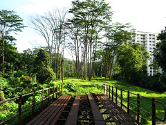
For me, the trip was like visiting an old friend whom you have not seen for - in this case - half a year. People change, they grow bald as they get older, but the Jurong Line landscape grows in the opposite way. What was once upturned soil is now a verdant grass patch.
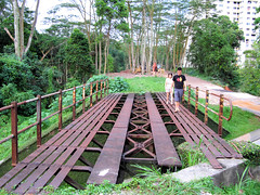
Left: Sunset Way Railway Bridge on June 1, 2008.
Right: The same place, on December 20, 2008.
Turning bald (or bushy) is just external change. We are not oblivious of what happens internally. I think/hope/believe I'm more courageous now when it comes to crossing a railway bridge. Previously I was scared stiff and the mind conjured doomsday scenarios to deter my legs from moving forward, you can read my adventure here. I have my Kanchanaburi trip to thank for in this case. I self-trained by crossing (only twice) what is arguably the most famous railway bridge in the world.
Don't stop, never give up. It helps not to look down at the river below when crossing the Sungei Ulu Pandan Railway Bridge. Chiong ah!
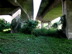
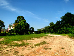
Some places are just too memorable to be forgotten, even when they are covered with grasses now. When I resumed my journey from Sungei Ulu Pandan Railway Bridge the last time, I started from the Ulu Pandan Park Connector. There was no way for me to get onto the track from the pavement below. So I walked until the Clementi Ave. 6 Flyover where there was a clearing. The clearing is gone today.
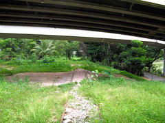
Left: The clearing to the right of the railway track on July 19, 2008.
Right: The clearing no more on December 20, 2008.
The stretch after the flyover had construction activity the previous time so I had to skirt around the area. This time there was none so I could walk uninterrupted to ITE College West (Clementi). With this stretch completed, I have officially 'conquered' the Old Jurong Line between the railway bridge at Sungei Ulu Pandan and Teban Flyover.
I broke new ground. I also saw what I thought were new landmarks. But I'm not sure, perhaps I wasn't paying attention last time.
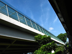
I also saw new use for old landmark. I'm referring to the Sungei Pandan Railway Bridge.
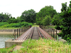
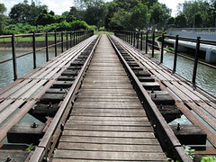
Left: The Sungei Pandan Railway Bridge on July 19, 2008.
Right: The same bridge on December 20, 2008. Can you see what has changed?
I didn't know why the authorities were so nice as to build a boardwalk until I consulted the street directory. Fact is, the disused railway bridge is the only link between the divided Ulu Pandan Park Connector.

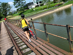
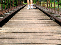
Left: Apologies to the lady. She had to use the sidewalk as we were blocking her way. I thought I saw the man in front turning back for her after he crossed the bridge, so sweet!
Right: FOYers, guess whose?
Railway Track Excavation
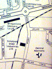
After a hearty lunch at former Jurong Ice Skating Rink, Chun See led a cavalry expedition to the rest of the Old Jurong Line. One of our stop points was at Jurong Port Road where, according to the old street directory, a railway crossing used to exist. The oldies were right also in claiming, while on the way back, that Bridgestone used to stand on the current SPH Print Centre. You can see this validated by the street directory.
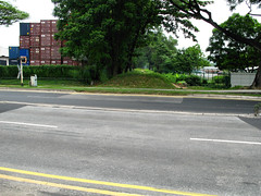
It was at Jurong Port Road that I saw my first track excavation.
I was excited, not over the discovery of old tracks since I already knew of a crossing at the location, but that of the nature of the excavation. Tracks do get unearthed like the stretch before Sunset Way but the digging happens on undeveloped forest floor. Coupled with the fact that the stretch is relatively well known, as least from the old street directory, the discovery, if you may call it, is not very exciting. In comparison, check out my photo of the place in September, sans excavator. A pavement was built over the tracks (that they managed to dig out the tracks prove it). That it was next to the road made it more significant.
I was reminded of railway structures turning up surreptitiously over the years, like bridge foundations during the construction of Somerset MRT and underground tracks next to Buona Vista MRT, not to forget the grand-daddy of Singapore Railway - the Tank Line - parts of it may still be buried underneath the road.
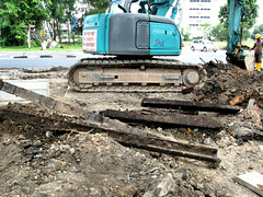
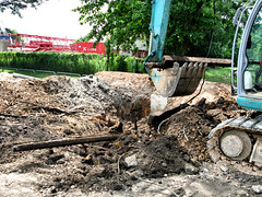
Tracks and sleepers excavated.
While not an expert on railway stuff, I can still recognize a track when I see one dug out. Those in my excavation photos looked like iron pickets used by SAF or what is called in general angle iron stakes. Thank Johnny for the name.
Angle iron stake. They even felt like iron pickets when I tried to lift one up. The track actually budged! I wanted to bring a souvenir home but found nothing suitable.
Before I end, here's a short video of the excavation. The process was pretty heart-wrenching. The excavator was trying to scoop the track up but to no avail. The track just refused to surrender. In the end machine triumphed. I wonder what happened to the tracks and sleepers afterward.




19 comments:
It looks like the Old Jurong Line has changed quite a bit in simply a short span of a few months.
I'm glad that I could join in the journey with you gentlemen. :)
PY, that was fast. Do you carry a blackberry or something? Haha.
So they have covered the Sungei Pandan Railway Bridge with planks, going to be easier to cross now. A lot of this on some of my cycling routes so it was nice to get an update, thanks!
I woke up early in the morning, and I saw your email, and starting reading your post. :)
I don't have a blackberry.
I wish I could join you guys for these explorations! Very nice blog you have here, Icemoon. Extremely good read.
I did venture into this Jurong line earlier this year. I posted my GPS log and pics on malsingmaps:
http://www.malsingmaps.com/forums/viewtopic.php?f=37&t=7642
Cheers!
Nice write-up, Icemoon. But did you call it "short"?
6 months, Singapore changed so much. We live in a fast world.
cek, I respect you guys for having the courage to explore the line including the yucky part in that kind of outfit. I wouldn't try unless I wear combat boots with my old (now disposable with the new camo outfit) no.4 slacks.
By the way, is that the Clementi Railway Tunnel in your photo?? And where were the last two photos taken?
Victor, was a bit disappointed you did not join us. You could have entertained us with your jokes.
Erm, I guess short enough. The photos and large font created a false impression.
Haha, PY, looks like you woke up just in time to taste the freshly baked cookies.
Siva, looks like there's one more good reason to keep the disused railway bridge intact. ^^
Peter, I sense the urgency to be more observational now. We never know when the Old Jurong Line follows the way of the Admiralty Line and the Buona Vista Line.
Icemoon,
I guess we were already prepared to get dirty :)
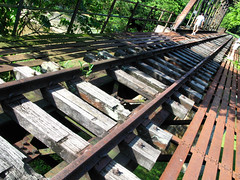
IIRC, the 2nd and 4th pics are the tunnel under Clementi Rd.
The squatter was found between the running KTM line and Clementi Rd.
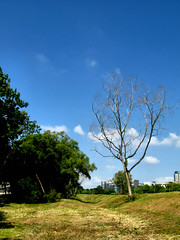
The 3rd pic was taken between Clementi Rd and Sunset Way (where the track curves).
I am glad we managed to go for that 'heritage trail' on 20 Dec. I just read in the Straits Times this morning that they plan to expand the IBP soon and judging from the sketch ST provided, they are likely to remove the railway track next to AYE.
BTW, I can't view your video.
Also, can you pls email me any photos that you took of the Tanjong Kling area. I am referring to the part where I stopped the car for you and Peter to take photos on our way back just after the Sumulun Bridge.
Thanks.
Vee, if you don't mind, I'm downloading your Clementi Road Tunnel photo for souvenir sake.
I don't know how you guys manage it. How do you drive or take a bus in that condition? :P
Sure Icemoon, have the pics =)
You've lots of great pics on your site. Do you bring along a large camera on these explorations? I was using a Canon a720is.
Well we don't really care about looking a bit dirty. We brought a clean shirt to change into. By the time we got back to civilization, the mud was caked and we just scraped most of it off. And proceeded to freshen up in some public toilet. Sometimes we feel amused when people give us the "why are you so dirty are you homeless?" look =D
Chun See, I fixed the video problem and emailed the pics.
Vee, thanks. I am using a Canon Powershot G7.
I just cycled to that area recently. As of 2013, after the return of the KTM land to Singapore, this bridge that crosses Sungei Pandan has been transformed and converted into a proper tar-laid bridge, which connects the Clementi Park connector to the Ulu Pandan Park connector. It also links to a very beautiful spiral bridge that goes across AYE to Pandan Gardens park connector. Its a huge transform compared to 10 years ago when i was there.
i would be glad to share the pictures with you!
Post a Comment