


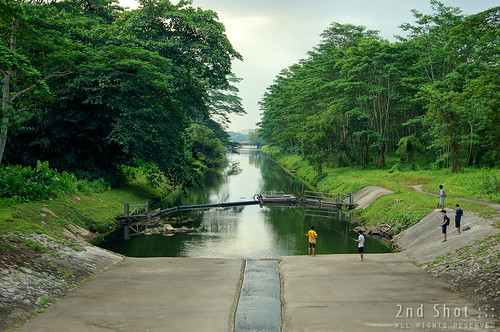
While I blog about geographical heritage, I do not usually pay much attention to the nature heritage around us. This has not changed much since 2009 when I failed to find the nutmeg trees in the Istana (what to do, without an identification guide, this city boy still can't). Few weeks ago however, this interesting sight of a transition between the man-made and the natural, where the canal meets the river, caught my attention.
This particular longkang is Sungei Seletar Simpang Kiri that gets emptied into Lower Seletar Reservoir. I pass by the section at Yio Chu Kang Road frequently but it is not everyday that the transformation of canal into river can be perceived so acutely. Often there would be water puddles left on the canal side from a higher water level or even from rain. When the level is right, you may see anglers descending onto the dry canal part indulging in their natural sport, just like the photo above.
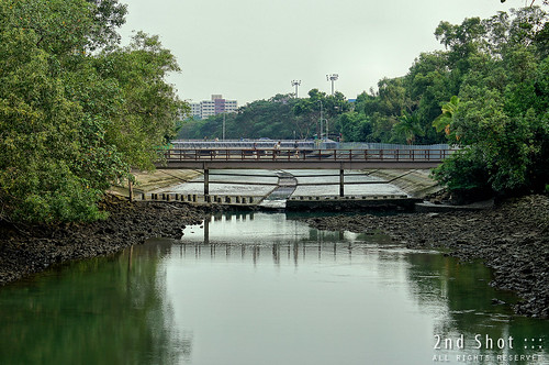
The canalisation of natural rivers has not been well-received. There have been calls from nature groups to leave natural rivers un-canalised and to keep the natural banks of rivers natural. Canalisation is one of the culprits in the degradation and loss of wildlife habitat locally. In a 2009 report you can read here, NSS wrote:
There is a penchant for the relevant authorities to tidy up rivers and streams by embanking them with concrete, converting them into ugly canals and monsoon drains, which are impoverished of the wildlife that lived originally along the flowing waters and banks. These canals and monsoon drains are a blight on our landscape, which has a charm of its own, more so if these canals and streams are de-concretised.
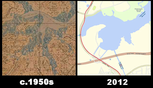
This section of Sungei Seletar Simpang Kiri may have been de-concretised in the past or it may be construed as an example of natural river by nature lovers, but as far as geographical heritage is concerned, this section was not original. Out of curiosity, I checked old maps to trace this sungei from the reservoir and compared the alignment with the sungei today. The alignments do not match. I should not be surprised. After referencing many old maps of Singapore I have come to the conclusion rivers were seldom this straight in the past.


0 comments:
Post a Comment